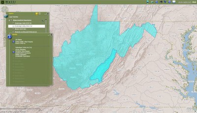
Water Supply Stress Index (WASSI)
USDA Forest Service
This summary is taken from text in the published assessment document referenced below.
Preface
Forest ecosystems provide many benefits and services, including clean water essential for life on Earth. Water supplies control plant growth and carbon storage to help regulate climate, as well as the variety of plant and animal species that exist in an ecosystem. Water availability and carbon sequestration are closely related ecosystem services that are influenced by human and environmental factors. To help natural resource planners and managers evaluate the balances and tradeoffs between these ecosystem services and make informed decisions in light of changing environmental conditions, Eastern Threat Center scientists are developing a web-based planning tool known as the Water Supply Stress Index (WaSSI) model.
WaSSI can predict how climate, land cover, and human population change may impact water availability and carbon sequestration at the watershed level and across the lower 48 United States, Mexico, Rwanda, and Burundi. WaSSI users can select and adjust temperature, precipitation, land cover, and water use factors to simulate an unlimited number of global change scenarios for user-determined timeframes through 2100. Simulation results are available as downloadable maps, graphs, and data files that users can apply to their unique information and project needs.
 About
About
WaSSI predicts the availability of water and other ecosystem services at local and national scales. An altered future climate, coupled with increasing human population and changing land cover resulting from land use decisions, will likely impact ecosystem water and carbon cycles. WaSSI predicts how these factors may impact water availability and carbon sequestration at the watershed level (about the size of a county) across the lower 48 United States and Mexico.
WaSSI supports informed decision making in a changing world. WaSSI generates useful information for natural resource planners and managers who must make informed decisions about water supplies and related ecosystem services in light of climatic, economic, and demographic change. Educators, researchers, and non-governmental organizations can also use WaSSI to gain insight into the effects of global change on water and carbon. WaSSI users can select from a variety of future climate scenarios, and adjust temperature, precipitation, land cover, and water use factors to simulate an unlimited number of global change scenarios for any timeframe from 1961 through the year 2100. Simulation results are available as downloadable graphs, maps, and data files that users can save and apply to their unique information and project needs.
WaSSI results are helping people through a variety of research projects and conservation activities. WaSSI users are addressing a range of natural resource questions in the United States and abroad. Forest Service research and planning efforts— including the Southern and Northern Forest Futures projects and Climate Change Adaptation and Mitigation Management Options project— use information generated by WaSSI to help land managers develop responses to climate change issues impacting forest products and ecosystem services. Eastern Threat Center scientists are actively collaborating with other federal agencies, universities, and non-governmental organizations to study emerging issues such as irrigation and energy development impacts on U.S. water and other natural resources. Scientists are also working with international organizations to aid development of resource conservation strategies. They are applying WaSSI in eastern and southern African countries to measure the potential impacts of land use practices on water quantity and in Inner Mongolian, Mongolian, and Chinese forest ecosystems to examine water and carbon interactions and their effects on regional biodiversity. Eastern Threat Center scientists have also conducted workshops in Mexico City to introduce land managers and researchers to WaSSI and demonstrate how the model could be implemented to address natural resource challenges in Mexico. These efforts not only support short- and long-term natural resource decision making; they also provide valuable data and information used to validate and enhance the WaSSI model.
Preferred citation
Sun, Ge. "WaSSI Ecosystem Services Model." WaSSI Ecosystem Services Model. USDA Forest Service Eastern Forest Environmental Threat Assessment Center, 2008. Web. <http://www.forestthreats.org/research/tools/WaSSI>.


